

GOOGLE MAP GUIDE #3
‘Travelling & Sightseeing’ in Google Maps
One of the wonderful features of Google Maps is the ability to go anywhere in the world and view what’s there. Millions of photos by anyone can be added for the enjoyment/education of others such as museums and public buildings. You can choose and village, town, city in the world and where there is a building labelled such as a shop, restaurant, pub etc. there will almost certainly be a business address, hours of business, menu (restaurant), website (if available), telephone number, review ratings & reviews/comments together with the popular visit times and peoples photos. Initially just hover your mouse over the marker/label to see a popup showing the brief description, click on the popup or marker to open the full details in the left pane. Click on the photograph area to open up the photo list in the left pane which you can scroll down and any you choose by clicking with open in the large right pane.
We’ve previously briefly described street view to see 360 deg viewing/moving in map and satellite modes so you should be ok to expand this to let your imagination take you to your bucket list destinations or revisit holiday locations.
Let me help you to explore Google maps to its fuller potential. Most of the civilized world has been mapped by travelling roads and streets – check it out. That means you can ‘travel’ along any road/street at your own speed, stop, swivel 360 and then move on!
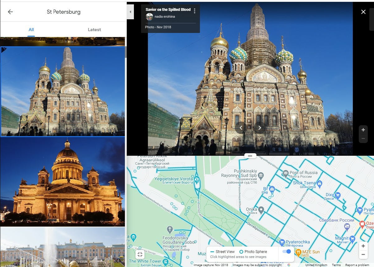
I’m choosing St Petersburg in Russia as it’s opulent, far away and somewhere we are not likely to be going this week!! As my Russian language is nonexistent and I don’t know where things are or what is worth looking at I start by choosing the city, county in the search box. This gives me the weather & local time, photos and some Quick Facts and hotels in the left pane and a street map view in the right. I clicked on the photos to give me a quick idea of what to look at and immediately in the right pane is the enlarged photo and in the bottom left corner is the pegman pointing/standing in an area. Hovering over him enlarges the view and turns it to street view. In the bottom left of that image is an enlarge button which will put the map under the photo. Zoom in to enlarge the view. Move the pegman as desired. Many of the buildings can be ‘entered’ and enable a ‘walk around’ with 360 rotation. Click on the floor circles to proceed. Zooming out from the street view photo 360 provides a satellite or overhead view of the area. You may need to copy the photo title and put it in the search box to help navigation.
I’m sure you will find out more features/nuances during your ‘travels’! All the above is also in Google Earth and probably a lot more!
 Return