

GOOGLE MAP GUIDE #2
Viewing Google Maps in Satellite View
It is easy to get into satellite view and view the area in photographic mode from above by simply clicking the image in the LH lower map area. Again we see the compass on the right so we can view from various directions. Whilst this is not relevant for a 2D view –ie directly overhead, below the compass is a 2D/3D toggle so in 3D rotating the tilted view can be useful. Again rolling the scroll wheel will zoom in or out. Zooming in will eventually launch street view. Zooming out will create a wider view which can also be achieved by clicking the next symbol on the right –a world icon. However this whilst providing a world view – you lose the close up function ability losing the compass and 2D/3D. CIick the world icon again and these return as does the image icons.
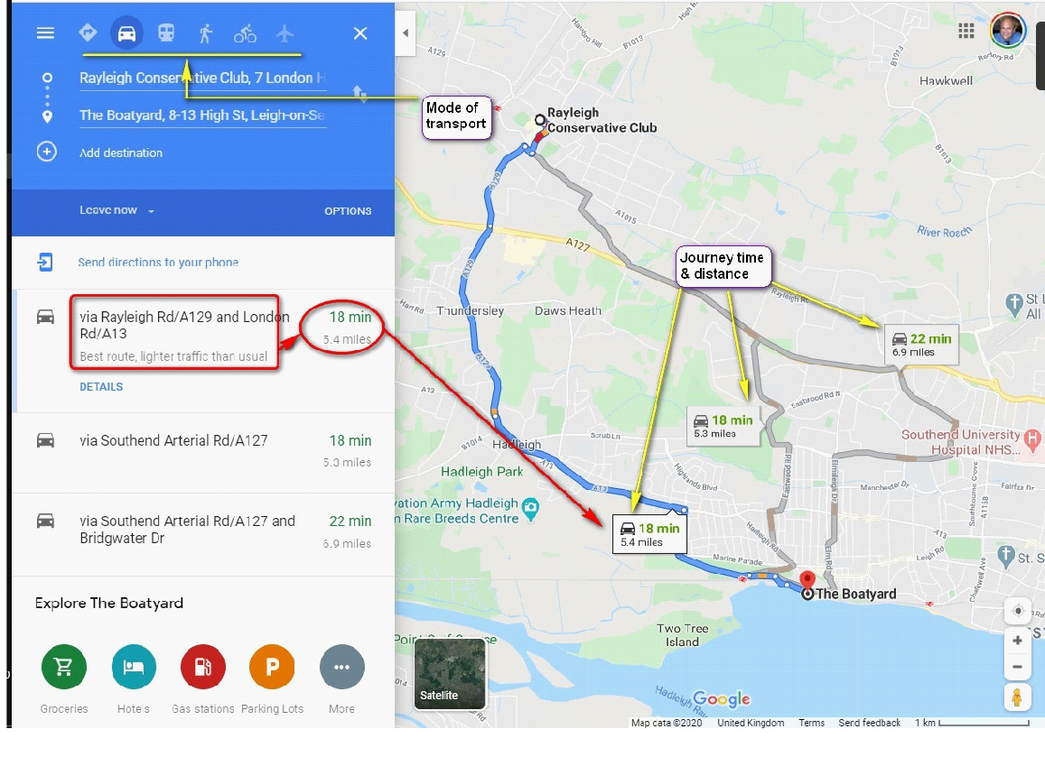
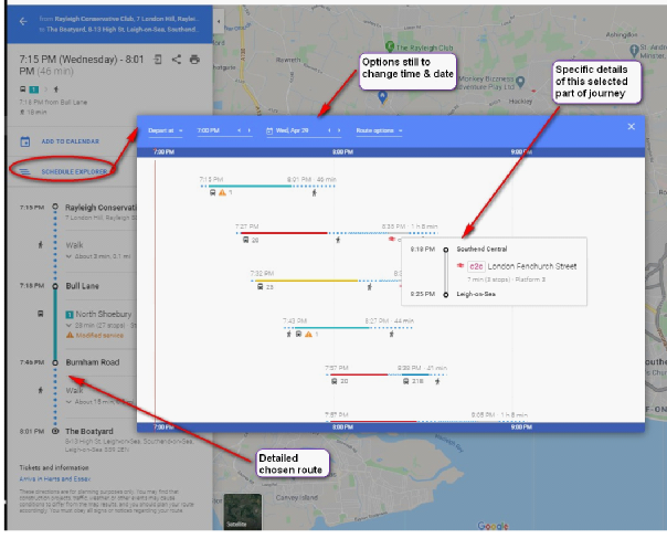
Viewing Google Maps for navigation, routes & times
One of the most common uses of Google maps is as a SatNav device for motorists providing up-

 Next
Return
Next
Return